
BACK TO HISTORY

ALLERTON HILL & BOSTON HARBOR MAPS
Hull, Nahant and Winthrop are the three towns in the Boston Basin that have USGS topographic maps and NOAA nautical charts that identify geographic and other features for their whole land area. All three are also peninsulas with hill-like features the USGS identifies as Capes and Islands. Hull has eight USGS-listed summits; Allerton Hill (115 ft.), Atlantic Hill (85 ft.), Center Hill (79 ft.), Green Hill (43 ft.), Hampton Hill (30 ft.), Sagamore Hill (85 ft.), Strawberry Hill (102 ft.), and Telegraph Hill (121 ft.). The USGS list includes Allerton Hill as a Summit, and nearby Point Allerton as a Cape, with an elevation of 23 ft.
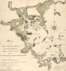
1775 MAP
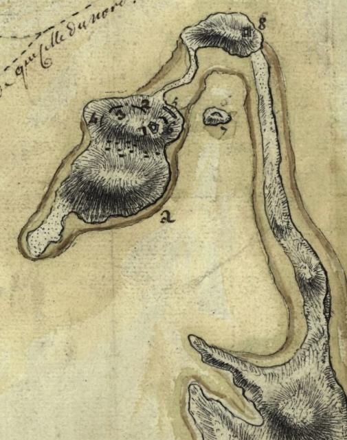
FRENCH TOPOGRAPHY MAP, DETAIL OF HULL, 1778
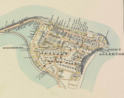
1903 MAP
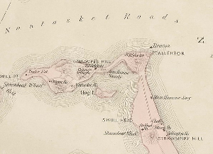
1879 MAP
CLICK MAP FOR LARGE VIEW
CLICK MAP FOR LARGE VIEW
CLICK MAP FOR LARGE VIEW